
Tanzbuche topographic map
Interactive map
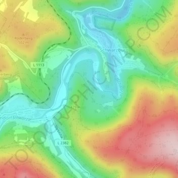
Click on the map to display elevation.
About this map
Name: Tanzbuche topographic map, elevation, terrain.
Average elevation: 413 m
Minimum elevation: 275 m
Maximum elevation: 612 m
Other topographic maps
Click on a map to view its topography, its elevation and its terrain.
Burkersdorfer Weg
Deutschland > Thüringen > Landkreis Saalfeld-Rudolstadt > Schwarzburg
Burkersdorfer Weg, Schwarzburg, Schwarzatal, Landkreis Saalfeld-Rudolstadt, Thüringen, 07427, Deutschland
Average elevation: 484 m
Schloßberg
Deutschland > Thüringen > Landkreis Saalfeld-Rudolstadt > Schwarzburg
Schloßberg, Schwarzburg, Schwarzatal, Landkreis Saalfeld-Rudolstadt, Thüringen, 07427, Deutschland
Average elevation: 398 m