
Le Testard topographic map
Interactive map
Click on the map to display elevation.
About this map
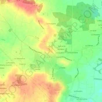
Name: Le Testard topographic map, elevation, terrain.
Average elevation: 37 m
Minimum elevation: 4 m
Maximum elevation: 67 m
Other topographic maps
Click on a map to view its topography, its elevation and its terrain.
L'Esnauderie
France > Pays de la Loire > Maine-et-Loire > Soulaire-et-Bourg > Bourg
L'Esnauderie, Bourg, Soulaire-et-Bourg, Angers, Maine-et-Loire, Pays de la Loire, France métropolitaine, 49460, France
Average elevation: 35 m