
Thank you for supporting this site ❤️
Make a donation
Make a donation
Cape Farman topographic map
Click on the map to display elevation.
Thank you for supporting this site ❤️
Make a donation
Make a donation
About this map
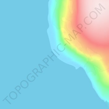
Name: Cape Farman topographic map, elevation, terrain.
Average elevation: 61 m
Minimum elevation: 0 m
Maximum elevation: 331 m
Thank you for supporting this site ❤️
Make a donation
Make a donation
Other topographic maps
Click on a map to view its topography, its elevation and its terrain.
Kane Island
Russia > Arkhangelsk Oblast > Primorsky District
The largely unglacierised Kane island has a maximum altitude of 282 m (925 ft). It is about 5.8 km (3.6 mi) in length, measured from north to south. The northeastern tip is called Cape Hellwald (Russian: мыс Гельвальда) while Cape Easter (Russian: мыс Пасхи) is in the southeast.
Average elevation: 79 m
Thank you for supporting this site ❤️
Make a donation
Make a donation
Bolshoy Solovetsky Island
Russia > Arkhangelsk Oblast > Primorsky District > Solovetskiy
Average elevation: 5 m
Thank you for supporting this site ❤️
Make a donation
Make a donation