
Thank you for supporting this site ❤️
Make a donation
Make a donation
Genappe topographic map
Click on the map to display elevation.
Thank you for supporting this site ❤️
Make a donation
Make a donation
About this map
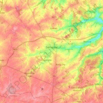
Name: Genappe topographic map, elevation, terrain.
Location: Genappe, Nivelles, Walloon Brabant, Wallonia, Belgium (50.55405 4.37560 50.65865 4.54157)
Average elevation: 134 m
Minimum elevation: 69 m
Maximum elevation: 171 m
Thank you for supporting this site ❤️
Make a donation
Make a donation
Other topographic maps
Click on a map to view its topography, its elevation and its terrain.
Quatre-Bras de Baisy-Thy
Belgium > Walloon Brabant > Nivelles > Genappe > Baisy-Thy > Quatre-Bras de Baisy-Thy
Average elevation: 146 m
Thank you for supporting this site ❤️
Make a donation
Make a donation