
Winkel topographic map
Interactive map
Click on the map to display elevation.
About this map
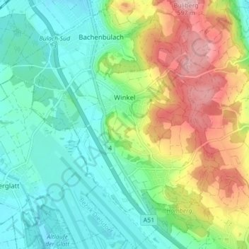
Name: Winkel topographic map, elevation, terrain.
Location: Winkel, Bezirk Bülach, Zürich, 8185, Schweiz (47.46493 8.53668 47.51159 8.58007)
Average elevation: 474 m
Minimum elevation: 410 m
Maximum elevation: 601 m
Other topographic maps
Click on a map to view its topography, its elevation and its terrain.
Niderrüti
Schweiz > Zürich > Bezirk Bülach > Winkel
Niderrüti, Winkel, Bezirk Bülach, Zürich, 8185, Schweiz
Average elevation: 470 m