
Thank you for supporting this site ❤️
Make a donation
Make a donation
Mbelei topographic map
Click on the map to display elevation.
Thank you for supporting this site ❤️
Make a donation
Make a donation
About this map
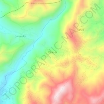
Name: Mbelei topographic map, elevation, terrain.
Location: Mbelei, Bumbuli, Tanga Region, Northern Zone, Tanzania (-4.84975 38.36879 -4.80975 38.40879)
Average elevation: 1,448 m
Minimum elevation: 1,176 m
Maximum elevation: 1,783 m
Thank you for supporting this site ❤️
Make a donation
Make a donation