
Messines topographic map
Interactive map
Click on the map to display elevation.
About this map
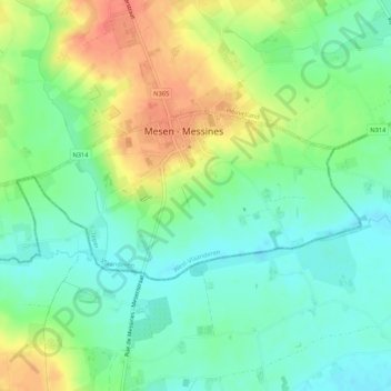
Name: Messines topographic map, elevation, terrain.
Location: Messines, Ypres, Flandre-Occidentale, Flandre, 8957, Belgique (50.75273 2.86963 50.76707 2.92247)
Average elevation: 38 m
Minimum elevation: 18 m
Maximum elevation: 68 m