
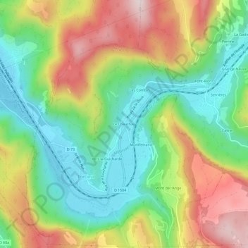
Le Chauchay topographic map
Interactive map
Click on the map to display elevation.
About this map
Name: Le Chauchay topographic map, elevation, terrain.
Average elevation: 458 m
Minimum elevation: 257 m
Maximum elevation: 749 m
Other topographic maps
Click on a map to view its topography, its elevation and its terrain.
Vers la Guicharde
France > Auvergne-Rhône-Alpes > Ain > Torcieu
Vers la Guicharde, Torcieu, Belley, Ain, Auvergne-Rhône-Alpes, France métropolitaine, 01230, France
Average elevation: 448 m
Les Combes
France > Auvergne-Rhône-Alpes > Ain > Torcieu
Les Combes, Torcieu, Belley, Ain, Auvergne-Rhône-Alpes, France métropolitaine, 01230, France
Average elevation: 459 m
Montferrand
France > Auvergne-Rhône-Alpes > Ain > Torcieu
Montferrand, Torcieu, Belley, Ain, Auvergne-Rhône-Alpes, France métropolitaine, 01230, France
Average elevation: 465 m