
Аим topographic map
Interactive map
Click on the map to display elevation.
About this map
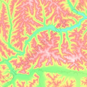
Name: Аим topographic map, elevation, terrain.
Average elevation: 473 m
Minimum elevation: 214 m
Maximum elevation: 819 m
Other topographic maps
Click on a map to view its topography, its elevation and its terrain.
Гарби
Гарби, Солнечный район, Krai de Jabárovsk, Distrito federal del Lejano Oriente, Rusia
Average elevation: 211 m
Isla Gran Chantar
Isla Gran Chantar, Тугуро-Чумиканский район, Krai de Jabárovsk, Distrito federal del Lejano Oriente, Rusia
Average elevation: 75 m