
Thank you for supporting this site ❤️
Make a donation
Make a donation
Tulsa topographic map
Click on the map to display elevation.
Thank you for supporting this site ❤️
Make a donation
Make a donation
About this map
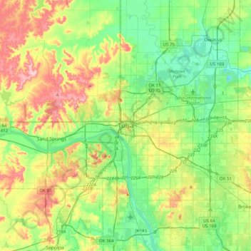
Name: Tulsa topographic map, elevation, terrain.
Location: Tulsa, Tulsa County, Oklahoma, 74172, United States (35.99568 -96.15291 36.31568 -95.83291)
Average elevation: 220 m
Minimum elevation: 166 m
Maximum elevation: 322 m
Thank you for supporting this site ❤️
Make a donation
Make a donation