
Make a donation
Marmolada topographic map
Click on the map to display elevation.
Make a donation
Marmolada
The ridge is composed of several summits, decreasing in altitude from west to east: Punta Penia 3,343 metres (10,968 ft), Punta Rocca 3,309 metres (10,856 ft), Punta Ombretta 3,230 metres (10,600 ft), Monte Serauta 3,069 metres (10,069 ft), and Pizzo Serauta 3,035 metres (9,957 ft). An aerial tramway goes to the top of Punta Rocca. During the ski season, the Marmolada's main ski run is open for skiers and snowboarders alike, making it possible to ski down into the valley.
Make a donation
About this map
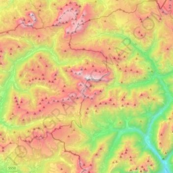
Name: Marmolada topographic map, elevation, terrain.
Location: Marmolada, Belluno, Veneto, Italy (46.34877 11.66152 46.49875 12.01600)
Average elevation: 1,896 m
Minimum elevation: 632 m
Maximum elevation: 3,320 m
Make a donation
Other topographic maps
Click on a map to view its topography, its elevation and its terrain.
Make a donation
Make a donation
Make a donation
Monte Schiara
Italy > Veneto > Belluno > Sedico
The Schiara (Italian: Monte Schiara) is a mountain in the southern Dolomites of Veneto in northern Italy. It is located just north of the town of Belluno, approximately 50 miles north of Venice. Monte Schiara has an elevation of 2,565 metres.
Average elevation: 1,852 m
Make a donation
Make a donation
Make a donation
Make a donation
Make a donation
Tre Cime di Lavaredo - Drei Zinnen
Italy > Veneto > Belluno > Auronzo di Cadore
Until 1919 the peaks formed part of the border between Italy and Austria-Hungary. Now they lie on the border between the Italian provinces of South Tyrol and Belluno and still are a part of the linguistic boundary between German-speaking and Italian-speaking majorities. The Cima Grande has an elevation of…
Average elevation: 2,242 m
Cortina d'Ampezzo
Italy > Veneto > Belluno > Cortina d'Ampezzo > Cortina d'Ampezzo
Among the surrounding mountains are Tofane to the west, Pomagagnon to the north, Cristallo to the northeast, Faloria and Sorapiss to the east, and Becco di Mezzodì, Croda da Lago and Cinque Torri to the south. Monte Antelao (Nantelou in Ladin) is at 3264 m the highest mountain in the Ampezzo Dolomites and the…
Average elevation: 1,649 m
Make a donation
Sas de Stria
Italy > Veneto > Belluno > Cortina d'Ampezzo
Sass de Stria is a mountain of the Veneto, Italy. It has an elevation of 2,477 meters. During the First World War, the mountain and surrounding area was the scene of fighting between Italy and Austria-Hungary.
Average elevation: 2,138 m
Make a donation
Pieve di Cadore
Italy > Veneto > Belluno > Pieve di Cadore > Pieve di Cadore
Average elevation: 1,116 m