
Thank you for supporting this site ❤️
Make a donation
Make a donation
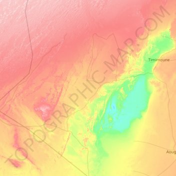
Charouine topographic map
Click on the map to display elevation.
Thank you for supporting this site ❤️
Make a donation
Make a donation
Charouine
Charouine lies at an elevation of 285 metres (935 ft) near an oasis, part of the Gourara region of northern Adrar Province. Groves of trees are found around the main town; to the north-west the terrain is dominated by rocky areas and sand dunes, while to the south-east near the village of Taguelzi the terrain falls away dramatically, featuring cliffs up to 50 metres (160 ft) high.
Thank you for supporting this site ❤️
Make a donation
Make a donation
About this map
Name: Charouine topographic map, elevation, terrain.
Average elevation: 312 m
Minimum elevation: 170 m
Maximum elevation: 471 m
Thank you for supporting this site ❤️
Make a donation
Make a donation