
Gemeinde Weppersdorf topographic map
Interactive map
Click on the map to display elevation.
About this map
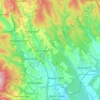
Name: Gemeinde Weppersdorf topographic map, elevation, terrain.
Average elevation: 396 m
Minimum elevation: 280 m
Maximum elevation: 659 m
Höchster Berg Weppersdorfs ist der Fuchsriegel mit einer Höhe von 380 m ü. A. (47.59277777777816.428611111111380).