
Spangenberg topographic map
Interactive map
Click on the map to display elevation.
About this map
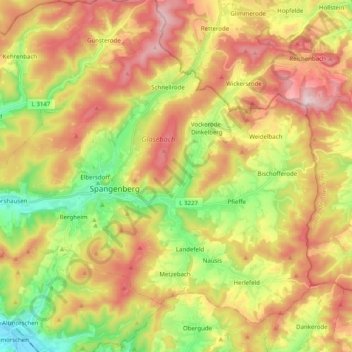
Name: Spangenberg topographic map, elevation, terrain.
Location: Spangenberg, Schwalm-Eder-Kreis, Hesse, 34286, Alemanha (51.06910 9.58246 51.17348 9.78113)
Average elevation: 374 m
Minimum elevation: 176 m
Maximum elevation: 585 m