
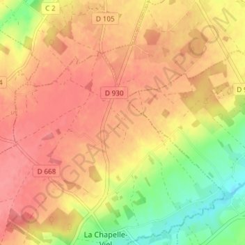
La Perrotière topographic map
Interactive map
Click on the map to display elevation.
About this map
Name: La Perrotière topographic map, elevation, terrain.
Average elevation: 251 m
Minimum elevation: 208 m
Maximum elevation: 275 m
Other topographic maps
Click on a map to view its topography, its elevation and its terrain.
Le Fay de la Lande
France > Normandie > Orne > La Chapelle-Viel
Le Fay de la Lande, La Chapelle-Viel, Mortagne-au-Perche, Orne, Normandie, France métropolitaine, 61270, France
Average elevation: 258 m