
Eischoll topographic map
Interactive map
Click on the map to display elevation.
About this map
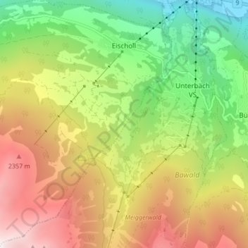
Name: Eischoll topographic map, elevation, terrain.
Location: Eischoll, Westlich Raron, Wallis, 3943, Schweiz (46.25551 7.73535 46.30214 7.79435)
Average elevation: 1,623 m
Minimum elevation: 631 m
Maximum elevation: 2,848 m
Other topographic maps
Click on a map to view its topography, its elevation and its terrain.
Raron
Schweiz > Wallis > Westlich Raron
Raron, Westlich Raron, Wallis, 3942, Schweiz
Average elevation: 1,712 m
Unterbäch VS
Schweiz > Wallis > Westlich Raron > Unterbäch
Unterbäch VS, Unterbäch, Westlich Raron, Wallis, 3944, Schweiz
Average elevation: 1,274 m
Breithorn
Schweiz > Wallis > Westlich Raron > Blatten
Breithorn, Blatten, Westlich Raron, Wallis, 3919, Schweiz
Average elevation: 2,914 m