
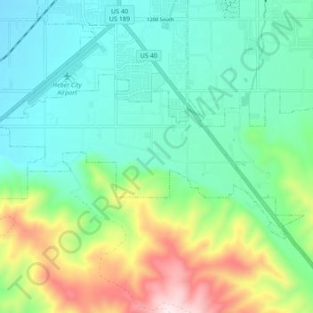
Daniel topographic map
Interactive map
Click on the map to display elevation.
About this map
Name: Daniel topographic map, elevation, terrain.
Average elevation: 1,868 m
Minimum elevation: 1,678 m
Maximum elevation: 2,364 m
Other topographic maps
Click on a map to view its topography, its elevation and its terrain.
Heber
Vereinigte Staaten von Amerika > Utah > Wasatch County
Heber, Wasatch County, Utah, 84032, Vereinigte Staaten von Amerika
Average elevation: 1,737 m