
Elathur topographic map
Click on the map to display elevation.
About this map
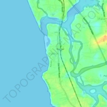
Name: Elathur topographic map, elevation, terrain.
Location: Elathur, Kozhikode, Kerala, 673303, India (11.32361 75.71854 11.36361 75.75854)
Average elevation: 7 m
Minimum elevation: -3 m
Maximum elevation: 31 m
Other topographic maps
Click on a map to view its topography, its elevation and its terrain.