
Felleringen topographic map
Interactive map
Click on the map to display elevation.
About this map
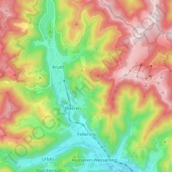
Name: Felleringen topographic map, elevation, terrain.
Average elevation: 799 m
Minimum elevation: 409 m
Maximum elevation: 1,299 m
Der Ort ist ein Zentrum des Gleitschirmfliegens. Die Sportler starten hauptsächlich von den Höhen des Markstein und des Drumont. 1999 fand hier der Paragliding World Cup statt. Das Gebiet ist aber auch für Wanderer interessant.