
Carlisle topographic map
Interactive map
Click on the map to display elevation.
About this map
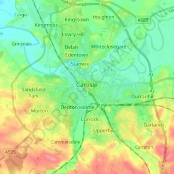
Name: Carlisle topographic map, elevation, terrain.
Location: Carlisle, Cumbria, North West England, England, United Kingdom (54.86497 -2.98940 54.93207 -2.87642)
Average elevation: 27 m
Minimum elevation: 5 m
Maximum elevation: 70 m
Other topographic maps
Click on a map to view its topography, its elevation and its terrain.