
Thank you for supporting this site ❤️
Make a donation
Make a donation
Ainaro topographic map
Click on the map to display elevation.
Thank you for supporting this site ❤️
Make a donation
Make a donation
About this map
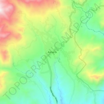
Name: Ainaro topographic map, elevation, terrain.
Location: Ainaro, East Timor (-9.03690 125.46482 -8.95690 125.54482)
Average elevation: 898 m
Minimum elevation: 385 m
Maximum elevation: 1,875 m
Thank you for supporting this site ❤️
Make a donation
Make a donation