
The Municipal District of Muinebeag topographic map
Interactive map
Click on the map to display elevation.
About this map
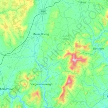
Name: The Municipal District of Muinebeag topographic map, elevation, terrain.
Average elevation: 129 m
Minimum elevation: 1 m
Maximum elevation: 789 m
Other topographic maps
Click on a map to view its topography, its elevation and its terrain.
River Lerr
River Lerr, The Municipal District of Carlow, County Carlow, Leinster, R93 Y381, Irland
Average elevation: 85 m