
Nagoya topographic map
Interactive map
Click on the map to display elevation.
About this map
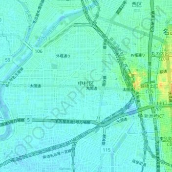
Name: Nagoya topographic map, elevation, terrain.
Location: 中村区, Nagoya, Präfektur Aichi, Chūbu, Japan (35.14493 136.82897 35.19166 136.89308)
Average elevation: 5 m
Minimum elevation: -5 m
Maximum elevation: 29 m