
Uri topographic map
Interactive map
Click on the map to display elevation.
About this map
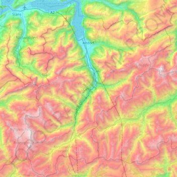
Name: Uri topographic map, elevation, terrain.
Location: Uri, Schweiz (46.52763 8.39736 46.99341 8.95780)
Average elevation: 1,886 m
Minimum elevation: 426 m
Maximum elevation: 3,594 m
Der Kanton Uri liegt in der Zentralschweiz zwischen dem Vierwaldstättersee im Norden und dem Gotthardpass im Süden. Uri ist einer der drei Urkantone (Gründungsmitglieder) der Eidgenossenschaft. Die anderen beiden sind Schwyz und Unterwalden. Aufgrund der Topographie mit einem Anteil an gebirgigen, unproduktiven Flächen von rund 56 Prozent wohnen drei Viertel der Einwohner im untersten Kantonsteil, in der Reussebene.
Other topographic maps
Click on a map to view its topography, its elevation and its terrain.