
Gemeinde Axams topographic map
Interactive map
Click on the map to display elevation.
About this map
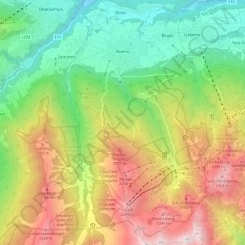
Name: Gemeinde Axams topographic map, elevation, terrain.
Location: Gemeinde Axams, Bezirk Innsbruck-Land, Tirol, 6094, Österreich (47.17086 11.25367 47.24657 11.32501)
Average elevation: 1,449 m
Minimum elevation: 645 m
Maximum elevation: 2,591 m