
Muna Island topographic map
Interactive map
Click on the map to display elevation.
About this map
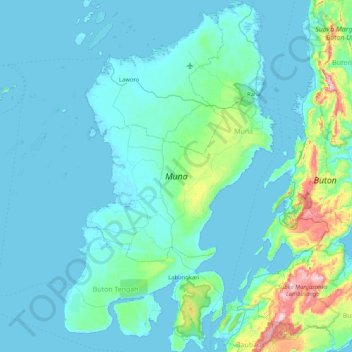
Name: Muna Island topographic map, elevation, terrain.
Location: Muna Island, Baubau, Southeast Sulawesi, Indonesia (-5.44129 122.26575 -4.61046 122.76915)
Average elevation: 70 m
Minimum elevation: -1 m
Maximum elevation: 744 m