
Hydro topographic map
Interactive map
Click on the map to display elevation.
About this map
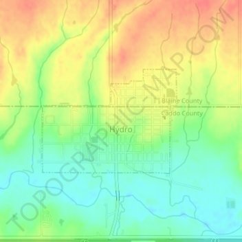
Name: Hydro topographic map, elevation, terrain.
Location: Hydro, Oklahoma, United States of America (35.54399 -98.58856 35.55564 -98.57007)
Average elevation: 471 m
Minimum elevation: 447 m
Maximum elevation: 497 m
Hydro is located near the northwestern corner of Caddo County at 35°32′56″N 98°34′40″W / 35.54889°N 98.57778°W / 35.54889; -98.57778 (35.548882, -98.577762), at an elevation of 1,557 feet (475 m). A small part of the town extends north into Blaine County.