
軽井沢町 topographic map
Interactive map
Click on the map to display elevation.
About this map
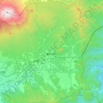
Name: 軽井沢町 topographic map, elevation, terrain.
Location: 軽井沢町, 北佐久郡, Präfektur Nagano, Japan (36.27840 138.50749 36.42439 138.65716)
Average elevation: 1,117 m
Minimum elevation: 535 m
Maximum elevation: 2,563 m