
Thank you for supporting this site ❤️
Make a donation
Make a donation
Worabe topographic map
Click on the map to display elevation.
Thank you for supporting this site ❤️
Make a donation
Make a donation
About this map
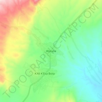
Name: Worabe topographic map, elevation, terrain.
Location: Worabe, Selti, Central Ethiopia Regional State, Ethiopia (7.81345 38.14730 7.89345 38.22730)
Average elevation: 2,114 m
Minimum elevation: 1,950 m
Maximum elevation: 2,445 m
Thank you for supporting this site ❤️
Make a donation
Make a donation
Other topographic maps
Click on a map to view its topography, its elevation and its terrain.