
Gemeinde Baden topographic map
Interactive map
Click on the map to display elevation.
About this map
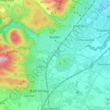
Name: Gemeinde Baden topographic map, elevation, terrain.
Location: Gemeinde Baden, Bezirk Baden, Niederösterreich, Österreich (47.96386 16.17203 48.02450 16.30320)
Average elevation: 288 m
Minimum elevation: 190 m
Maximum elevation: 652 m
Die komplette Liste der Statistik Austria ist in: Topographische Siedlungskennzeichnung nach STAT