
Thank you for supporting this site ❤️
Make a donation
Make a donation
Cospudener See topographic map
Click on the map to display elevation.
Thank you for supporting this site ❤️
Make a donation
Make a donation
Cospudener See
Abend am Südufer mit Bistumshöhe und Belantis
Thank you for supporting this site ❤️
Make a donation
Make a donation
About this map
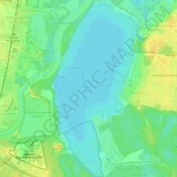
Name: Cospudener See topographic map, elevation, terrain.
Average elevation: 115 m
Minimum elevation: 105 m
Maximum elevation: 128 m
Thank you for supporting this site ❤️
Make a donation
Make a donation