
Col du Petit Mont Cenis topographic map
Interactive map
Click on the map to display elevation.
About this map
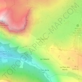
Name: Col du Petit Mont Cenis topographic map, elevation, terrain.
Average elevation: 2,196 m
Minimum elevation: 1,707 m
Maximum elevation: 2,748 m
Other topographic maps
Click on a map to view its topography, its elevation and its terrain.
Refuge du Petit Mont Cenis
France > Auvergne-Rhône-Alpes > Savoie > Val-Cenis > Les Coulours
Refuge du Petit Mont Cenis, Mont Cenis, Les Coulours, Bramans, Val-Cenis, Saint-Jean-de-Maurienne, Savoie, Auvergne-Rhône-Alpes, France métropolitaine, 73500, France
Average elevation: 2,248 m