
Corenc topographic map
Interactive map
Click on the map to display elevation.
About this map
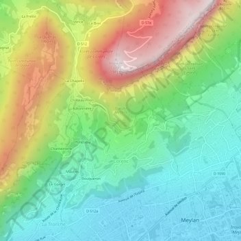
Name: Corenc topographic map, elevation, terrain.
Average elevation: 621 m
Minimum elevation: 213 m
Maximum elevation: 1,341 m
L'altitude de la commune va de 230 mètres (église Sainte-Thérèse) à 1 328 m (fort du Saint-Eynard), le village se situant à 530 m (église Saint-Pierre).