
Merenschwand topographic map
Interactive map
Click on the map to display elevation.
About this map
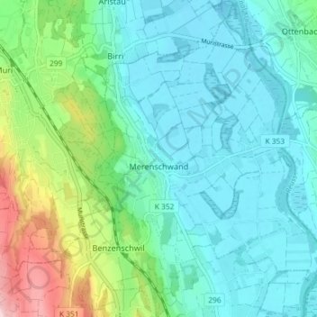
Name: Merenschwand topographic map, elevation, terrain.
Location: Merenschwand, Bezirk Muri, Aargau, 5634, Schweiz (47.23726 8.35077 47.28649 8.41096)
Average elevation: 432 m
Minimum elevation: 380 m
Maximum elevation: 610 m
Other topographic maps
Click on a map to view its topography, its elevation and its terrain.
Oberrüti
Schweiz > Aargau > Bezirk Muri
Oberrüti, Bezirk Muri, Aargau, 5647, Schweiz
Average elevation: 435 m