
Thindlu topographic map
Click on the map to display elevation.
About this map
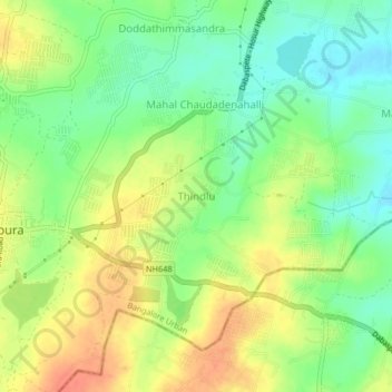
Name: Thindlu topographic map, elevation, terrain.
Location: Thindlu, Anekal, Bangalore Urban, Karnataka, 562125, India (12.84340 77.78715 12.88340 77.82715)
Average elevation: 870 m
Minimum elevation: 848 m
Maximum elevation: 894 m
Other topographic maps
Click on a map to view its topography, its elevation and its terrain.