
Cavan-Belturbet Municipal District topographic map
Interactive map
Click on the map to display elevation.
About this map
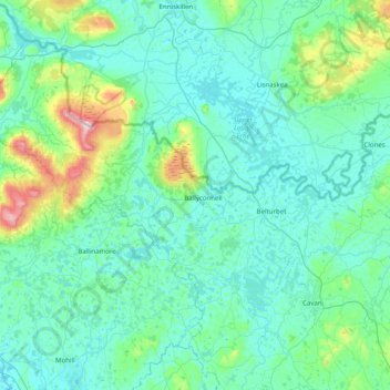
Name: Cavan-Belturbet Municipal District topographic map, elevation, terrain.
Location: Cavan-Belturbet Municipal District, County Cavan, Irland (53.93434 -8.05818 54.30454 -7.26230)
Average elevation: 111 m
Minimum elevation: 37 m
Maximum elevation: 653 m
Other topographic maps
Click on a map to view its topography, its elevation and its terrain.
Lear
Lear, Canningstown ED, Bailieborough-Cootehill Municipal District, County Cavan, Ulster, Irland
Average elevation: 189 m
Swanlinbar
Swanlinbar, Cavan-Belturbet Municipal District, County Cavan, Irland
Average elevation: 97 m
Gubnafarna
Gubnafarna, Kinawley ED, Cavan-Belturbet Municipal District, County Cavan, Irland
Average elevation: 178 m