
Beaverton topographic map
Interactive map
Click on the map to display elevation.
About this map
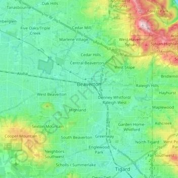
Name: Beaverton topographic map, elevation, terrain.
Location: Beaverton, Washington County, Oregon, VS (45.42652 -122.86733 45.54296 -122.74366)
Average elevation: 106 m
Minimum elevation: 43 m
Maximum elevation: 386 m