
Колыма topographic map
Interactive map
Click on the map to display elevation.
About this map
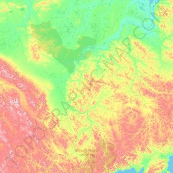
Name: Колыма topographic map, elevation, terrain.
Average elevation: 421 m
Minimum elevation: -1 m
Maximum elevation: 2,671 m
Other topographic maps
Click on a map to view its topography, its elevation and its terrain.
Ягодное
Rusia > Óblast de Magadán > Ягоднинский муниципальный округ
Ягодное, Ягоднинский муниципальный округ, Óblast de Magadán, Distrito federal del Lejano Oriente, 686230, Rusia
Average elevation: 584 m