Hustopeče u Brna topographic map
Interactive map
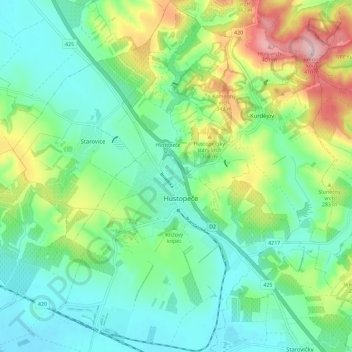
Click on the map to display elevation.
About this map
Name: Hustopeče u Brna topographic map, elevation, terrain.
Average elevation: 237 m
Minimum elevation: 165 m
Maximum elevation: 410 m

Click on the map to display elevation.
Name: Hustopeče u Brna topographic map, elevation, terrain.
Average elevation: 237 m
Minimum elevation: 165 m
Maximum elevation: 410 m