
Nadia topographic map
Interactive map
Click on the map to display elevation.
About this map
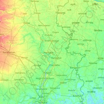
Name: Nadia topographic map, elevation, terrain.
Location: Nadia, West Bengal, 741402, India (22.55000 87.80000 23.95000 89.20000)
Average elevation: 13 m
Minimum elevation: -3 m
Maximum elevation: 58 m