
Mauterndorf topographic map
Interactive map
Click on the map to display elevation.
About this map
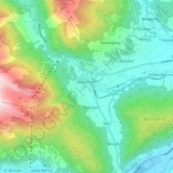
Name: Mauterndorf topographic map, elevation, terrain.
Location: Mauterndorf, Bezirk Tamsweg, Salzburg, 5570, Österreich (47.09874 13.61996 47.16521 13.71740)
Average elevation: 1,377 m
Minimum elevation: 1,017 m
Maximum elevation: 2,241 m
Haupteinkommensquelle ist der Fremdenverkehr mit jährlich 245.000 Übernachtungen. Besondere touristische Höhepunkte sind im Sommer das Mittelalterfest, die berühmten Samsonumzüge und im Winter das Familienskigebiet Grosseck-Speiereck.