
Thank you for supporting this site ❤️
Make a donation
Make a donation
Yangyuan County topographic map
Click on the map to display elevation.
Thank you for supporting this site ❤️
Make a donation
Make a donation
About this map
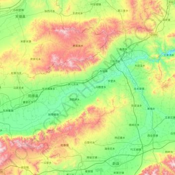
Name: Yangyuan County topographic map, elevation, terrain.
Location: Yangyuan County, Zhangjiakou, Hebei, China (39.89428 113.90292 40.37386 114.80599)
Average elevation: 1,163 m
Minimum elevation: 730 m
Maximum elevation: 2,104 m
Thank you for supporting this site ❤️
Make a donation
Make a donation
Other topographic maps
Click on a map to view its topography, its elevation and its terrain.