
Kamojang, Kawah topographic map
Interactive map
Click on the map to display elevation.
About this map
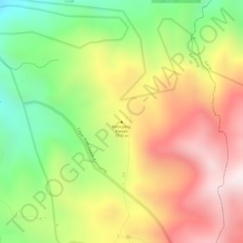
Name: Kamojang, Kawah topographic map, elevation, terrain.
Location: Kamojang, Kawah, Bandung, Java occidental, Indonésie (-7.12505 107.79995 -7.12495 107.80005)
Average elevation: 1,589 m
Minimum elevation: 1,247 m
Maximum elevation: 1,897 m
Other topographic maps
Click on a map to view its topography, its elevation and its terrain.
Papandayan
Indonésie > Java occidental > Bandung
Papandayan, Bandung, Java occidental, Indonésie
Average elevation: 2,319 m
Gunung Patuha
Indonésie > Java occidental > Bandung
Gunung Patuha, Bandung, Java occidental, 40973, Indonésie
Average elevation: 2,103 m