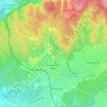
Luxeuil-les-Bains topographic map
Interactive map
Click on the map to display elevation.
About this map
Name: Luxeuil-les-Bains topographic map, elevation, terrain.
Average elevation: 320 m
Minimum elevation: 249 m
Maximum elevation: 439 m

Click on the map to display elevation.
Name: Luxeuil-les-Bains topographic map, elevation, terrain.
Average elevation: 320 m
Minimum elevation: 249 m
Maximum elevation: 439 m