
Murigny topographic map
Interactive map
Click on the map to display elevation.
About this map
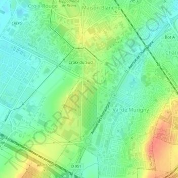
Name: Murigny topographic map, elevation, terrain.
Average elevation: 97 m
Minimum elevation: 78 m
Maximum elevation: 127 m
Other topographic maps
Click on a map to view its topography, its elevation and its terrain.
Parc des anciens des Trois Rivières
France > Grand Est > Marne > Reims
Parc des anciens des Trois Rivières, Les Châtillons, Reims, Marne, Grand Est, France métropolitaine, 51100, France
Average elevation: 94 m