
Borken topographic map
Interactive map
Click on the map to display elevation.
About this map
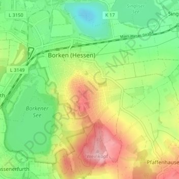
Name: Borken topographic map, elevation, terrain.
Location: Borken, Schwalm-Eder-Kreis, Hesse, 34582, Allemagne (51.02121 9.25854 51.06185 9.31627)
Average elevation: 202 m
Minimum elevation: 137 m
Maximum elevation: 295 m