
Puttgarden topographic map
Interactive map
Click on the map to display elevation.
About this map
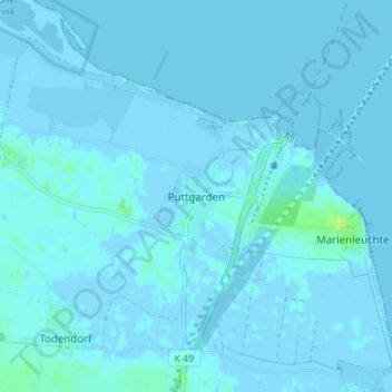
Name: Puttgarden topographic map, elevation, terrain.
Average elevation: 1 m
Minimum elevation: -6 m
Maximum elevation: 12 m
Other topographic maps
Click on a map to view its topography, its elevation and its terrain.
Gold
Allemagne > Schleswig-Holstein > Ostholstein > Fehmarn > Albertsdorf
Gold, Albertsdorf, Fehmarn, Ostholstein, Schleswig-Holstein, Allemagne
Average elevation: 1 m