
Diepoldsau topographic map
Interactive map
Click on the map to display elevation.
About this map
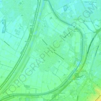
Name: Diepoldsau topographic map, elevation, terrain.
Location: Diepoldsau, Wahlkreis Rheintal, Sankt Gallen, 9444, Schweiz (47.36508 9.61657 47.40463 9.67414)
Average elevation: 409 m
Minimum elevation: 401 m
Maximum elevation: 425 m