
Kenda topographic map
Interactive map
Click on the map to display elevation.
About this map
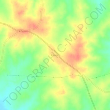
Name: Kenda topographic map, elevation, terrain.
Location: Kenda, Puruliya, West Bengal, India (23.17592 86.49488 23.21592 86.53488)
Average elevation: 228 m
Minimum elevation: 201 m
Maximum elevation: 252 m