
West Lafayette topographic map
Interactive map
Click on the map to display elevation.
About this map
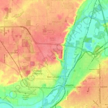
Name: West Lafayette topographic map, elevation, terrain.
Location: West Lafayette, Tippecanoe County, Indiana, VS (40.40002 -86.96234 40.48963 -86.88789)
Average elevation: 192 m
Minimum elevation: 150 m
Maximum elevation: 225 m